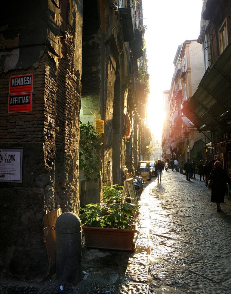
Dawn smelled of pine pitch and cold coffee; a dented mug left a pale ring on a smooth rock while a marmot whistled from across the lake.
I stood there for a long beat, watching light crawl up the jagged teeth of the range. It felt like a private moment — short-lived, because this loop is no secret.
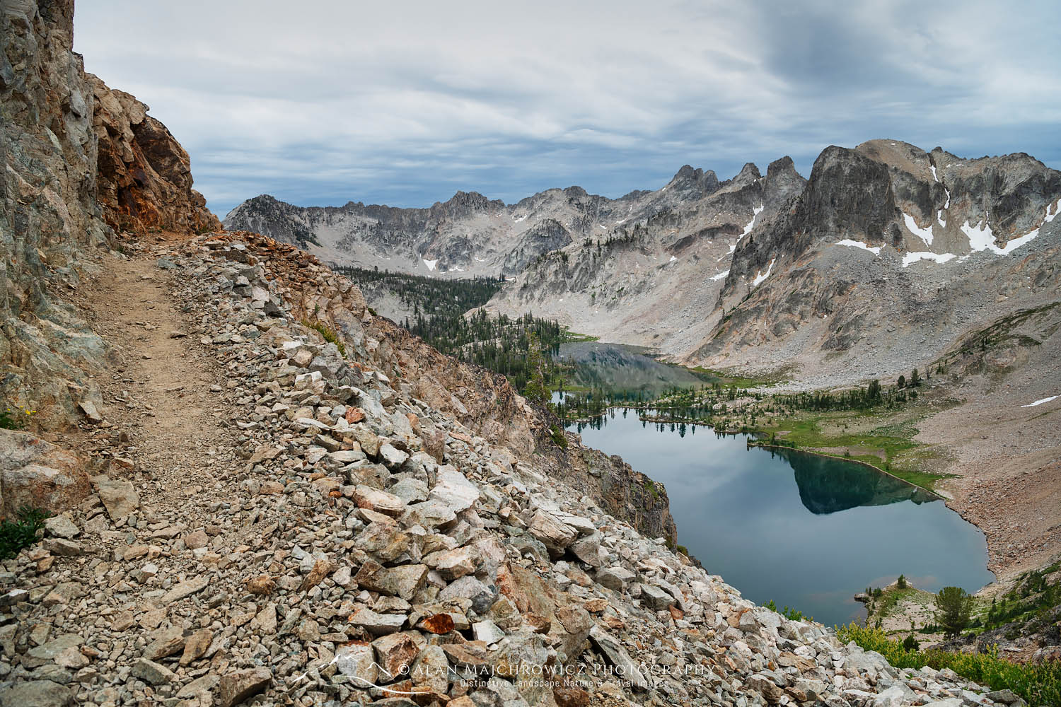
From that quiet start I want to pull back and look at what three days in the Sawtooths can tell us right now: a wilderness that’s spectacular, strained, and utterly addictive for those who find their way in. My route was clockwise on the Alice–Toxaway loop in early July; I’d do it counterclockwise next time. Little things mattered — a detour up Sand Mountain Pass that I hadn’t planned turned out to be the trip’s most luminous hour.
First light on the loop
The Alice–Toxaway loop is one of the area’s classic backpacking circuits: roughly 17–19 miles, about 3,000 feet of gain, and scenery that keeps rearranging itself — tarns, talus, steep passes and lake-bowl campsites where you can step into mirror-calm water. Trailhead parking at Tin Cup/Pettit Lake fills early in high season, and wilderness permits are the free, self-issued kind you grab at the trailhead before you go. Campfires are banned in the Alice and Toxaway drainages, and the route is known for high creek crossings and lingering snow on some passes well into summer. (discoversawtooth.org, alltrails.com)
Why the counterclockwise suggestion? Dynamics. Walking the loop opposite the crowd’s typical flow gives the best midday light on the lakes and makes for better campsite options at the end of day one if you want an easier acclimatization. I learned that while pawing through a map with coffee rings on my notebook, which — small confession — I do more often than I should.
The pull of Sand Mountain Pass
I almost missed Sand Mountain Pass. It was a half-spur that felt impulsive at mile three, and then the trail turned into twenty lazy switchbacks that eased the climb but never dulled the drama. The pass sits on a ribbon of reddish, sandy mineral deposits that earned the name — you can see the color in the rock if you duck close enough. The view down into the South Fork of the Payette felt, if I may be sentimental, like a private painting: layered ridgelines, a spatter of lakes, and a sky that wanted to stay late. If you backtrack this route, give the pass the time it deserves. (outdoorproject.com)
Voices on the trail
“Might sound sappy, but I gotta say — that pass just stops you,” Maya Ellis, 34, a software engineer who does long weekends whenever she can, told me at a lunchrock beside Toxaway. “I went clockwise the first day and thought I had it figured out. Then I saw the map from the other side and, oh man — there’s just more to see early on if you flip it.” She twirled a loose lace as she spoke, smudges of trail dust on her thumb.
Tom Ryder, 58, who runs a volunteer trail crew and wore a hat with an old national forest logo, was blunter about the realities: “We love seeing people get out here, but trailheads are packed. Parking is a mess some mornings, and, well, we’re not getting any more hands on deck from the agency side.” He shrugged, then added, “You learn to carry a worn golf glove in your pack — cuts from packing poles, you know? — but the bigger problem is keeping campsites healthy.” His voice tightened a bit when he mentioned illicit fire rings left by previous parties. (Which, yes, you shouldn’t do.)
Trails, visitors, and what’s shifting
The Sawtooth National Recreation Area and its wilderness are feeling a steady uptick in visitors over the last decade, a trend that accelerated around the pandemic and didn’t fully reverse. Local reporting has tracked the jump in annual visits and chronicled the strain on a lean Forest Service staff that relies heavily on nonprofits and volunteers to keep trail miles passable and facilities functional. That grassroots patchwork is impressive, but it’s also a sign the system is being stretched. (idahostatesman.com, columbiainsight.org)
On a broader scale, national research and industry reports show the number of Americans getting outside has kept climbing: the outdoor participation base grew in recent years, with more casual participants joining hikes and camping trips and an increasingly diverse demographic making use of public lands. That’s great for public health and local economies, but it makes managing wear-and-tear — human waste, erosion, campsite crowding — a bigger job. The reality is likely more complicated than “more people equals worse trails”; some places benefit from public attention, funding, and stewardship. Still, tensions are real. (outdoorindustry.org, fws.gov)
A contradictory truth: access versus preservation
Here’s a mild paradox: popularity has helped justify advocacy and volunteer funding for the Sawtooths, but it also creates the very pressures those efforts try to mitigate. Trail stewardship groups report record seasons clearing blowdown and repairing tread, and the area’s volunteer ethic is both a strength and a warning sign — what happens if volunteer burnout hits during a bad fire year? Sources remain conflicted on whether visitation will stabilize or grow; the last few seasons have been unpredictable. The question nudges at policy and funding choices: is the right answer more boots on the ground, user fees, stricter quotas, or better education? The community debate keeps opening up.
Practical takeaways for readers
If you’re planning three days on the Alice–Toxaway loop, a few on-the-ground notes that helped me: pick up the free wilderness permit at the trailhead; plan for a no-campfire trip; bring a wag bag or be prepared to pack out human waste in the most heavily used basins; aim for counterclockwise if you want the best midday light on the lakes; and, honestly, try to start early — parking at Tin Cup fills fast in July. Good maps matter. So do lightweight stoves and a sense of patience when you find a perfect campsite already taken.
A short digression: I still remember a man in his seventies I met at Pettit Lake who had an old cassette tape of John Denver songs and hummed along while he packed. It was, for a moment, perfectly out of time — a little like hearing a dial tone in an iPhone world.
Why this matters beyond postcards
Public lands are where private wonder meets public policy. The Sawtooths, beloved and visible, are a microcosm of larger questions about access, stewardship, and how a society sustains spaces that belong to everyone. Funding, staffing, and real community investment matter. So does the small-scale behavior of each hiker — choosing to pack out trash, resist a campfire in a banned basin, and leave campsites as you found them. If one person reading this changes one habit, that matters.
One last note from me — a brief, personal aside: I spent three nights under those peaks and left with mud on my boots, a sunburned nose, and a stubborn conviction that we owe these places better than casual neglect. Also, I’ll be trying the loop the other way next season. See you on the pass, maybe with a worn glove in my pocket.
Practical resources and reading
For planning and current rules, the Sawtooth area’s local guides and trail pages list distances, regs, and warnings about closures and snowpack. Volunteer organizations and local reporting have been central in tracking changing visitation and maintenance needs. If you want a straightforward trail description and tips, the local Sawtooth resources and trail guides are good starting points. (discoversawtooth.org, alltrails.com, columbiainsight.org)